Schladming
Bike & Hike Planai – Krahbergzinken
Mountainbike tour
Data:

Tour description
This Bike & Hike tour leads from Planet Planai through the Talbach Gorge into the Untertal valley and via the Planai Loop (304) up to the Planai. From the middle station, the Uphill Flow Trail can optionally be used.
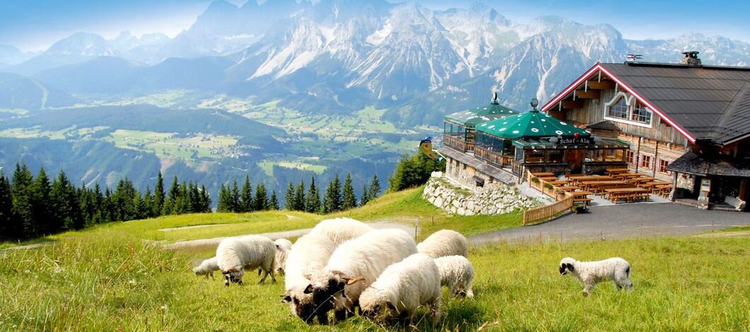
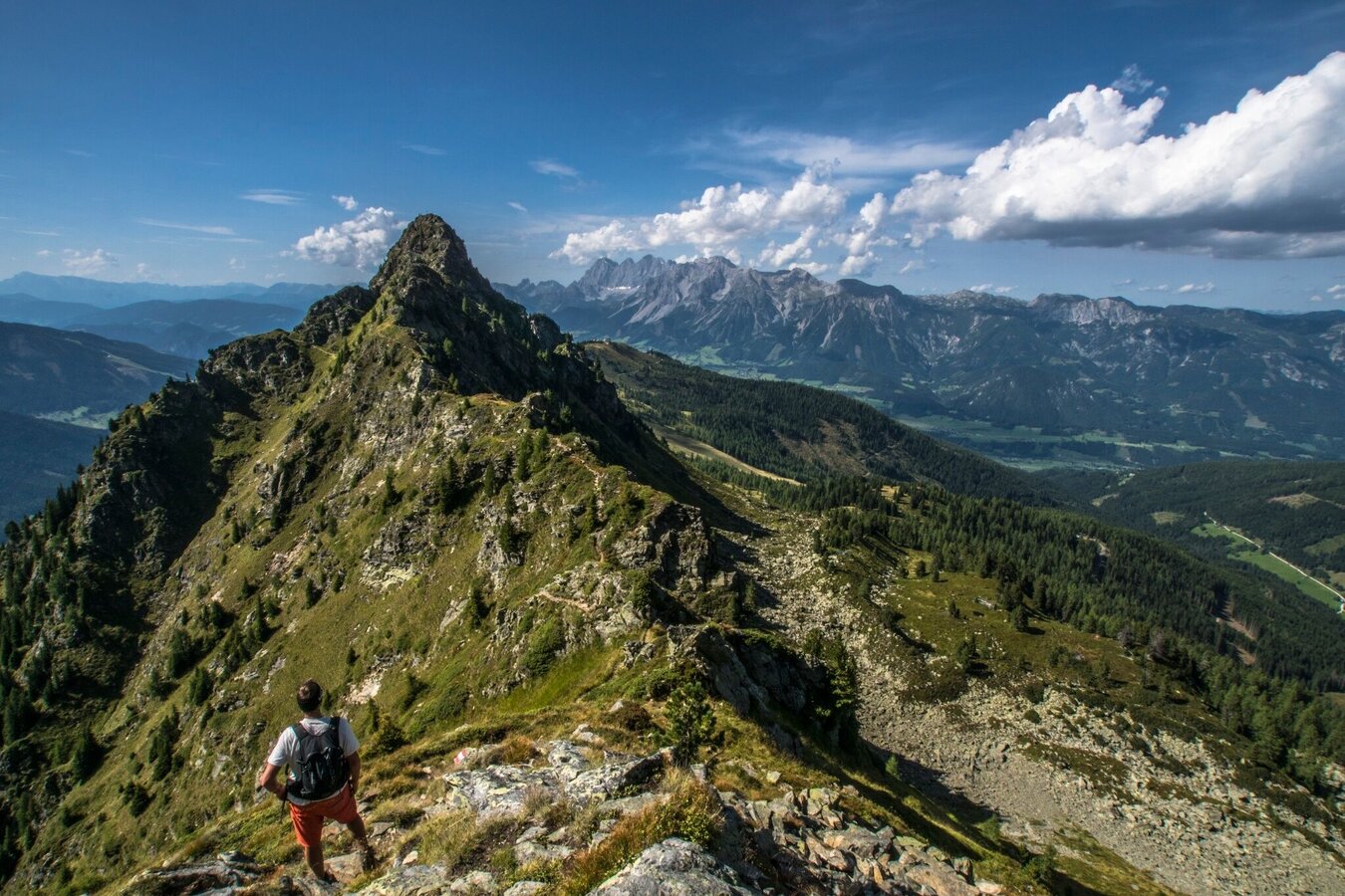
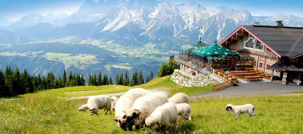
At the Schafalm, the bike can be parked and charged. From there, the hike to the Krahbergzinken begins, offering beautiful panoramic views.
The descent is either via the Planaistraße or via the trails in the Bikepark Planai.
Please note: The Bikepark Schladming can only be used during operating hours and requires a fee.
Bike total: 04:25 h, 34.2 km, 1,125 m elevation gain
Hike total: 02:40 h, 5.6 km, 370 m elevation gain
The tour
moderate
Starting and end point
Valley station Planet Planai
Tour characteristics
Distance: 39.8 km
Fitness (4/6)
Skills (4/6)
Information
Distance: 39.8 km
Duration:
7:00 h
Ascent: 1495 m
Descent: 1495 m
highest point: 2134 m
Best season
Jan
Feb
Mar
Apr
May
Jun
Jul
Aug
Sep
Oct
Nov
Dec
Map, elevation profile & further information
Start at Planet Planai and first head towards the Evangelical Church. From there, the route leads to the Talbachschenke and through the shady Talbach Gorge into the Untertal valley. Continue with a gentle climb to the Landalm and into Untertal-Dorf.
From here, follow the signs of the Planai Loop (304) via Michlbauer and Gföller to the Janerweg. Via the Fastenbergweg you reach the junction with the Planaistraße.
Now continue uphill on the Planaistraße towards the Planai. At the middle station, you can – if the Bikepark Schladming is open – optionally take the Uphill Flow Trail to the top station (subject to a fee). If the bike park is closed, the ascent continues entirely via the Planaistraße.
At the top, near the Schafalm or the mountain station, the bike can be parked and charged. From there, the hike to the Krahbergzinken begins. After returning, the descent is either via the Planaistraße or – if open – via the flow trail in the Bikepark Schladming back to Schladming and the starting point.
From Salzburg: Follow the A10 to Altenmarkt. There, join the B320 and continue towards Liezen. Take the Schladming exit at the level of the JET petrol station, turn right and follow Coburgstraße to the Planai parking area on the left side.
From Graz: Follow the A9 to Liezen. There, join the B320 and continue towards Schladming. Take the Schladming exit at the level of the JET petrol station, turn left and follow Coburgstraße to the Planai parking area on the left side.
Parking is available in sufficient numbers at the Planet Planai parking area.
Take the train from Radstadt or St. Michael to Schladming. From there, it is about a 3-minute ride by bike to the starting point. Alternatively, travel directly to the stop “Planet Planai”, where bike rental options are available on site.
ÖBB timetable information.
ÖBB timetable information.
Stay Safe on Your Bike & Hike
Weather conditions in the mountains can change quickly. Thunderstorms, wind, fog and sudden temperature drops are serious hazards. Plan your tour realistically and don’t overestimate your abilities.
In case of thunderstorms: Avoid summits, ridgelines and isolated trees.
Emergency numbers:
140 – Mountain Rescue
112 – European emergency number
Recommended equipment:
Helmet, suitable bike and hiking clothing, sturdy shoes, sufficient water.
Always lock your bike.
There are E-bike charging stations along the route (see map/elevation profile) – bring your charger.
For via ferrata routes: Via ferrata set, helmet, appropriate footwear.
- Combine the tour with a hike on the Planai Panorama Circular Trail or up to the Krahbergzinken. If you want to shorten the tour, you can comfortably take the Planai gondola up to the middle station.
- Plan breaks: Along the route, many huts and inns invite you to stop for a relaxing break and enjoy regional specialties.
- E-mountain bike: With electric support, the tour is also suitable for less experienced bikers. There are several e-bike charging stations along the route. Their locations can be seen on the map and in the elevation profile, so you can plan your tour and possible charging stops easily
For further information, please contact us at:
Tourismusverband Schladming-Dachstein
- Tel.: +43 3687 233 10
- info@schladming-dachstein.at
- Information offices


