Naturpark Sölktäler
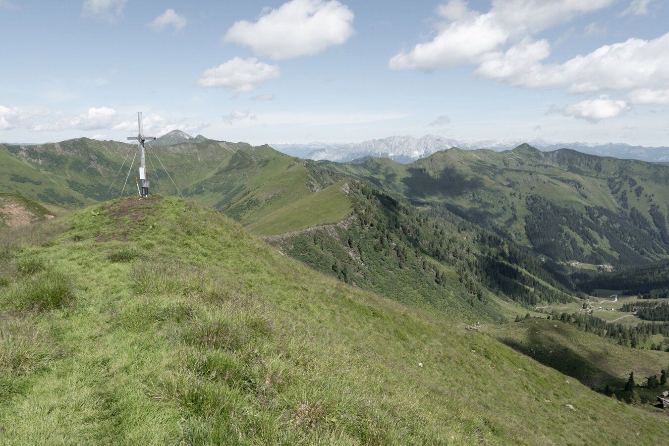
Großes Bärneck from Mößna
Mountain tour
Data:
Tour description
A hike in the Sölktäler Nature Park that will let you unwind. From the small village of Mößna, the trail leads up to the Große Bärneck mountain. Forest sections, alpine flora, and beautiful panoramic views are included.
The tour
moderate
publicly accessible
Starting point
Naturparkpavillon Mössna bzw. siehe weitere bei den Parkmöglichkeiten
Destination
Naturparkpavillon Mössna
Tour characteristics
Distance: 13.9 km
Fitness (4/6)
Skills (4/6)
Information
Distance: 13.9 km
Duration:
6:00 h
Ascent: 1090 m
Descent: 1090 m
highest point: 2071 m
Best season
Jan
Feb
Mar
Apr
May
Jun
Jul
Aug
Sep
Oct
Nov
Dec
Map, elevation profile & further information
From the town center of Mößna, follow the trail markings #902/909 slightly uphill into “Seifrieding”. After the road turns more south in a big right-hand bend, you reach a bridge where hiking trail #902/909 branches off left up into Mößnakar and to Gstemmerscharte.
Continue up the forest road and three hairpin bends, then the hiking trail branches off from the road. Shortly afterwards you cross the forest road once more and then walk steadily uphill on the north-eastern slope into Mößnakar. The path up to the Gstemmerscharte wind gap becomes a little steeper. From the gap you take path #911 south towards Bärneck. Along the ridge you finally reach the summit of the Großes Bärneck at 2,071 m. The way back is via the same route.
Continue up the forest road and three hairpin bends, then the hiking trail branches off from the road. Shortly afterwards you cross the forest road once more and then walk steadily uphill on the north-eastern slope into Mößnakar. The path up to the Gstemmerscharte wind gap becomes a little steeper. From the gap you take path #911 south towards Bärneck. Along the ridge you finally reach the summit of the Großes Bärneck at 2,071 m. The way back is via the same route.
In Pruggern or Espang, exit the B320 Ennstal federal highway and follow
the L712 Steiner Straße to Stein an der Enns. In the town, turn onto the
L704 Erzherzog-Johann-Straße into the Großsölk valley. Follow the L704
through the villages of Gatschberg, Feista, and Fleiß to Mößna. The
nature park pavilion with a hiking portal is located at the southern
entrance to the town. Parking is available on the parking lot at the nature park pavilion.
Arrival at Stein/Enns train station with ÖBB.
Cab Stefan Mayer: +43 676 54 09 858
Valley bus from July 11 to September 13, 2026 - this makes crossings in the Sölktäler Nature Park possible. You can also travel comfortably by train and the valley bus will take you to the starting point of your hike. Click here for the timetable.
Cab Stefan Mayer: +43 676 54 09 858
Valley bus from July 11 to September 13, 2026 - this makes crossings in the Sölktäler Nature Park possible. You can also travel comfortably by train and the valley bus will take you to the starting point of your hike. Click here for the timetable.
Weather changes, rapid drop in temperature, thunderstorms, wind, fog and snow fields are objective dangers and require the right behavior on the way. Hut keepers are experienced mountain connoisseurs, they can give good tips on the weather and the course of the trail. Lack of equipment, overestimation of one's own abilities, carelessness, poor physical condition and a wrong assessment can lead to critical situations. During thunderstorms: avoid peaks, ridges and rope belays at all costs.
GPS data and orientation aids: Available GPS data - as well as hiking maps - are only an orientation aid, since they can never represent an exact image or the richness of detail of a path in reality. Especially in the case of danger spots, it must therefore always be decided in the end on the basis of the conditions on site whether and how the further course of the path looks like.
In case of emergency, please dial the following emergency numbers:
No. 140 - for alpine emergencies - Austria-wide
No. 112 - Euro emergency call GSM emergency call service
Take rainproof and warm clothes and enough water, possibly also a snack, wear shoes with non-slip profile soles. A first aid kit should also be in your backpack.
SummitLynx- Your digital summit and hut book - available worldwide and always with you!Mountain guides from the region: www.schladming-dachstein.at/mountainguides
For more information, please contact the Schladming Dachstein Tourist Office - Sölktäler Nature Park Information Center:
Phone: +43 3687 23310 501
mailto:info@schladming-dachstein.at
Stein an der Enns 107
8961 Sölk
The brochure “Schladming-Dachstein Hiking” is available in all information offices in the region.


