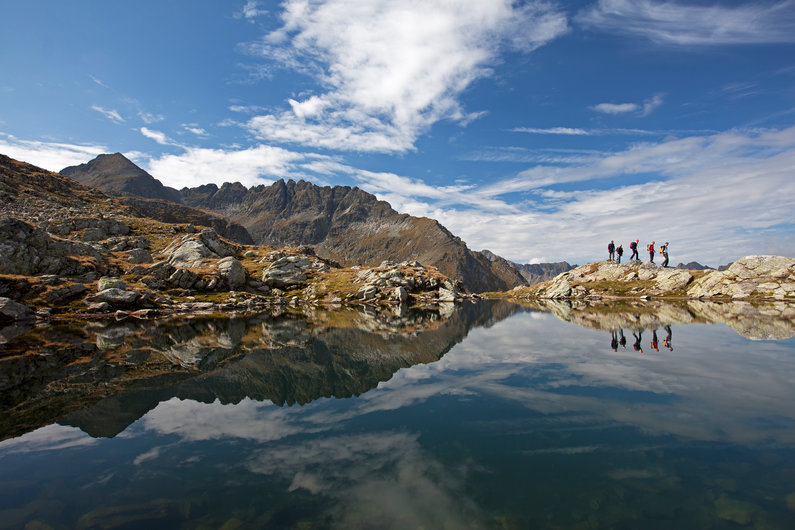
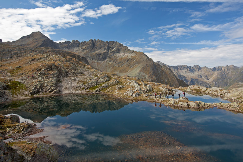
A world of water in abundance, the Schladminger Tauern extends out to the south of the Dachstein massif and the mountain town of Schladming, every bit the equal of its prominent counterpart, the Dachstein, in terms of natural beauty and alpine elevations. Here, hundreds of kilometers of hiking paths lead to impressive summits and countless picturesque mountain tarns.
The alpine paths through the Schladminger Tauern are undoubtedly some of the most beautiful hikes in the Schladming-Dachstein Region, quite capable of presenting mountaineers with all the challenges they could hope for. That said, surefootedness, good physical condition, a head for heights and the correct equipment are essential for those wishing to discover the most beautiful side of this mountain world.
The Schladminger Tauern High Trail has been awarded the Austrian Hiking Quality Seal. This underlines the quality of the trail, the signage, the special nature of the experience points as well as the refreshment and overnight accommodation options.
The Schladminger Tauern High Trail leads largely through alpine terrain and is secured with steel cables in short sections. These passages are generally very exposed and should only be taken by surefooted hikers with plenty of mountain experience. Having mountaineering equipment appropriate to the tour is a matter of course. In bad weather, the difficulty of the Höhenweg increases substantially.
Especially at the beginning of the season, you are likely to encounter fields of old snow – in some locations, even all summer long. That’s why it is vital for you to check current weather conditions and incorporate them into your tour planning. Please bear in mind that weather conditions in the high mountains can often change dramatically at a moment’s notice.
5-day-tour
Schladminger Tauern High Trail
Numerous high-alpine trails run along the peaks and ridges, which together form the long-distance hiking trail of the Schladminger Tauern High Trail. This is also partly a section of the Central Alpine Trail 02 through Austria. The Schladminger Tauern Höhenweg runs in 7 daily stages over more than 80 km. The shorter 5-day tour of approx. 45 km spans the mountain paths around the Rohrmoos valleys Obertal and Untertal and ultimately takes you to the Seewigtal.
An overview of the 5 stages
Starting point Hochwurzenhütte (reachable with the summit cable car Hochwurzen or via hiking trail no. 60 from Rohrmoos). From the Hochwurzen, the trail leads after just a few minutes along the beautifully laid out path up to the long grassy ridge of the Rossfeld. From this easily accessible panoramic mountain, you descend in a southerly direction to the depression of the Latterfußsattel with signposts for several branch-offs.
The further course of the trail is formed by trail no. 773 coming from the Obertal, which now leads from the ridge through a forest interspersed with many Swiss stone pines up to the popular panoramic summit of the Guschen (1,983 m). From the summit cross of the Guschen, the trail first leads over the Schneidergipfel and over the western flanks of the Hochfeld and the elevation of the Schiedeck (2,339 m).
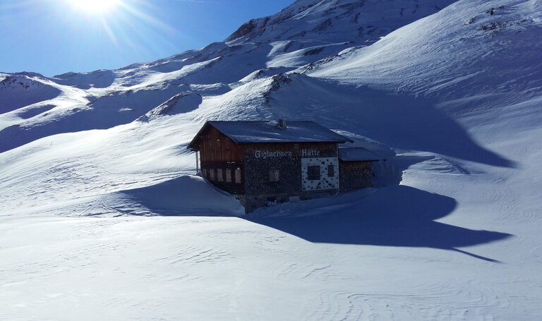
The Klammsee and the Brettersee, as well as the Kammspitze are the centerpiece of this great trail. The end is formed by many small serpentines that wind down over a steep slope to the Ignaz-Mattis-Hütte and the Giglachseehütte at the Giglachseen lakes.
Detailed tour description for stage 1 of the Schladminger Tauern High Trail
Variantes from Ursprungalm
- The first option is suitable, for example, if you only arrive in the region in the afternoon and still want to start with an overnight stay in a hut. By bus from Schladming and Rohrmoos to the Ursprungalm (or by car from Pichl or Schladming). From the Ursprungalm in about 1 hour to the Giglachseehütte or 1 1/4 hours to the Ignaz Mattis Hütte. (Alpenvereinshütte).
Tour description for the short hike from Ursprungalm - The 2nd variant is an alternative to the classic 1st stage from the Hochwurzen. From the Ursprungalm to the so-called Kranzl. Descent via the Brotrinnl to the Oberhütte. From the Oberhütte path no. 702 to the Akarscharte (2,315 m). Possibility to climb the summit of the Steirische or Lungauer Kalkspitze (from Akarscharte approx. 1/2 hour). Then descend via Znachsattel to the Giglachseehütte or Ignaz-Mattis-Hütte. Duration approx. 4.5 to 5 hours.
Tour description for the Steirische Kalkspitze variant
"Original variant" over the Rotmandlspitze
Starting from the Giglachseehütte or the Ignaz-Mattis-Hütte, trail no. 702 now leads to the eastern end of the Giglachseen. From here, the path climbs moderately into the outer Knappenkar and subsequently climbs quite steeply in places to the Rotmandlspitze (2,453 m). From there it continues to the Kruckeckscharte (2,303 m). From here the trail descends in large serpentines until we reach the beautifully situated Keinprechthütte at 1,872m above sea level.
Here you will find a detailed tour description with elevation profile and map.
Variant past the Duisitzkarsee
From the Ignaz-Mattis-Hütte or Giglachseehütte over the Murspitzsattel on path no. 775 to the Duisitzkarsee (1,648 m) with the well-known huts Duisitzkarhütte and Fahrlechhütte and from there over the Neualm to the Keinprechthütte.
Starting from the Keinprechthütte, we follow trail no. 702 through a large cirque until we reach a fork in the trail. Along the stone pine soils to the Trockenbrotscharte (2,237 m). Two path variants are offered: Either the high trail 702A - starting from the Landawirtseehütte or via the normal trail to the Inner Göriachwinkel. From here the path leads to the Gollingscharte (2,326 m). From the Gollingscharte there is the possibility to climb the summit of the Hochgolling (2,863 m). For the ascent to the summit, you need to be sure-footed, have a head for heights and have alpine experience. From the Gollingscharte descend via an ice or scree field to the "Götterplatz" Gollingwinkel. In a quarter of an hour from there you reach the Gollinghütte.
Here you will find a detailed tour description with elevation profile and map.
To Hochgolling summit
From the Gollingscharte you have the opportunity to climb to the summit of Hochgolling (2,863 m). Climbing the summit requires sure-footedness, a head for heights and alpine experience.
Immediately after the Gollinghütte the Steinriesenbach is crossed. In many serpentines, trail no. 702 now leads up to the Greifenberg . At an altitude of about 2,450 m, a field of view opens up on all sides. In front of us is the Greifenbergsee and the summit cross of the Greifenberg (2,618 m). From the summit you have the best view of the Klafferkessel.
A steep alpine trail leads down to the upper Klafferscharte. Over snow or scree fields further down to the actual heart, the Klafferkessel. Past countless lakes and lakes to the lower Klafferscharte. Now a steep path leads in large loops down to the outer Lämmerkar. After crossing the Waldhornbach, we reach the Preintalerhütte and the Waldhornalm.
Detailed tour description with with elevation profile and map.
You start your tour at Preintalerhütte and Waldhornalm, where you cross over the creek and follow Höfertsteig #782 towards Neualmscharte/Planai. At the trail junction "Höfertsteig" you keep right (staying on trail #782), now hiking uphill towards Neualmscharte gap. Approximately after 2 hours you reach the gap, providing a great view throughout the Seewigtal valley with its 3 lakes. From there, the narrow trail at first descends through a steep chute. Eventually the trail gets a little less steep and the scenery becomes greener shortly before you reach the Obersee lake - the first of 3 lakes in the Seewigtal valley. You walk out of the valley along the shore and further down via another terrace and through clear forest to the Hüttensee lake.
Passing by along the slope above the lake you reach Hans-Wödl-Hütte where you can enjoy some refreshments or an additional overnight stay. After taking a break at the hut you continue your way down into the valley along the well-maintained hiking trail. Shortly before reaching the Steirischer Bodensee lake you can make a small side-tour to the waterfall. Along the shore of the Bodensee you walk to Forellenhof inn (directly at the lake) and further out to the trail head and car parking at Seewigtalstüberl inn, from where the bus takes you back to Schladming.
Detailed tour description of stage 5 with with elevation profile and map.
7-day-tour
Schladminger Tauern High Trail
Along the Schladminger Tauern High Trail you hike for 7 days through the heart of the Schladminger Tauern mountain range. Past dilapidated huts and the foundations of miners' quarters, which bear witness to the historic mining past around Schladming. Pristine torrents with roaring waterfalls and many small tributaries from the headwaters of the Tauern water landscape make this hike so attractive. The 7-day tour covers more than 80 km and you can expand this with different variants.
An overview of the 7 stages
Starting point Hochwurzenhütte (reachable with the summit cable car Hochwurzen or via hiking trail no. 60 from Rohrmoos). From the Hochwurzen, the trail leads after just a few minutes along the beautifully laid out path up to the long grassy ridge of the Rossfeld. From this easily accessible panoramic mountain, you descend in a southerly direction to the depression of the Latterfußsattel with signposts for several branch-offs.
The further course of the trail is formed by trail no. 773 coming from the Obertal, which now leads from the ridge through a forest interspersed with many Swiss stone pines up to the popular panoramic summit of the Guschen (1,983 m). From the summit cross of the Guschen, the trail first leads over the Schneidergipfel and over the western flanks of the Hochfeld and the elevation of the Schiedeck (2,339 m).
The Klammsee and the Brettersee, as well as the Kammspitze are the centerpiece of this great trail. The end is formed by many small serpentines that wind down over a steep slope to the Ignaz-Mattis-Hütte and the Giglachseehütte at the Giglachseen lakes.
Detailed tour description for stage 1 of the Schladminger Tauern High Trail
Variantes from Ursprungalm
- The first option is suitable, for example, if you only arrive in the region in the afternoon and still want to start with an overnight stay in a hut. By bus from Schladming and Rohrmoos to the Ursprungalm (or by car from Pichl or Schladming). From the Ursprungalm in about 1 hour to the Giglachseehütte or 1 1/4 hours to the Ignaz Mattis Hütte. (Alpenvereinshütte).
Tour description for the short hike from Ursprungalm - The 2nd variant is an alternative to the classic 1st stage from the Hochwurzen. From the Ursprungalm to the so-called Kranzl. Descent via the Brotrinnl to the Oberhütte. From the Oberhütte path no. 702 to the Akarscharte (2,315 m). Possibility to climb the summit of the Steirische or Lungauer Kalkspitze (from Akarscharte approx. 1/2 hour). Then descend via Znachsattel to the Giglachseehütte or Ignaz-Mattis-Hütte. Duration approx. 4.5 to 5 hours.
Tour description for the Steirische Kalkspitze variant
-
"Original variant" over the Rotmandlspitze
Starting from the Giglachseehütte or the Ignaz-Mattis-Hütte, trail no. 702 now leads to the eastern end of the Giglachseen. From here, the path climbs moderately into the outer Knappenkar and subsequently climbs quite steeply in places to the Rotmandlspitze (2,453 m). From there it continues to the Kruckeckscharte (2,303 m). From here the trail descends in large serpentines until we reach the beautifully situated Keinprechthütte at 1,872m above sea level.
Here you will find a detailed tour description with elevation profile and map.
Variant past the Duisitzkarsee
From the Ignaz-Mattis-Hütte or Giglachseehütte over the Murspitzsattel on path no. 775 to the Duisitzkarsee (1,648 m) with the well-known huts Duisitzkarhütte and Fahrlechhütte and from there over the Neualm to the Keinprechthütte.
Starting from the Keinprechthütte, we follow trail no. 702 through a large cirque until we reach a fork in the trail. Along the stone pine soils to the Trockenbrotscharte (2,237 m). Two path variants are offered: Either the high trail 702A - starting from the Landawirtseehütte or via the normal trail to the Inner Göriachwinkel. From here the path leads to the Gollingscharte (2,326 m). From the Gollingscharte there is the possibility to climb the summit of the Hochgolling (2,863 m). For the ascent to the summit, you need to be sure-footed, have a head for heights and have alpine experience. From the Gollingscharte descend via an ice or scree field to the "Götterplatz" Gollingwinkel. In a quarter of an hour from there you reach the Gollinghütte.
Here you will find a detailed tour description with elevation profile and map.
To Hochgolling summit
From the Gollingscharte you have the opportunity to climb to the summit of Hochgolling (2,863 m). Climbing the summit requires sure-footedness, a head for heights and alpine experience.
Immediately after the Gollinghütte the Steinriesenbach is crossed. In many serpentines, trail no. 702 now leads up to the Greifenberg . At an altitude of about 2,450 m, a field of view opens up on all sides. In front of us is the Greifenbergsee and the summit cross of the Greifenberg (2,618 m). From the summit you have the best view of the Klafferkessel.
A steep alpine trail leads down to the upper Klafferscharte. Over snow or scree fields further down to the actual heart, the Klafferkessel. Past countless lakes and lakes to the lower Klafferscharte. Now a steep path leads in large loops down to the outer Lämmerkar. After crossing the Waldhornbach, we reach the Preintalerhütte and the Waldhornalm.
Detailed tour description with with elevation profile and map.
Shortly after the Preintalerhütte, the Sonntagskarbach stream is crossed. Then follows a fork in the road from where trail no. 702 branches off to the right and winds its way up through the Trattenkar in steep serpentines. Trail no. 702 turns right to the Trattenscharte , where at 2,408 m the highest point of the tour is reached. A short descent leads to a small labyrinth of lakes, similar to the Klafferkessel. Along the southeast flanks of the Schareck and above the Stummer Almen, until we reach Karlkirchen, a small rock dome. Continue to Lassacheralm and from there either along the hiking trail or following the forest road through a high forest until the Breitlahnhütte is reached. It is possible to stay overnight here, alternatively you can follow path #786 into the valley past the Schwarzensee to the Putzentalalm and spend the night there.
Detailed tour description of stage 5 to Schwarzensee with with elevation profile and map.
Alternative 5th stages of the 7-day tour
on the Schladminger Tauern High Trail
For the stage from the Preintalerhütte to the Putzentalalm there are also alternative trail options:
- via trail #784 and the Rettingscharte to the Schwarzensee and the Putzentalalm,
- or via trail #777 and #793 via the Waldhorntörl and Kaiserscharte to the Putzentalalm.
From the Breitlahnhütte you follow path no. 702/786 into the valley and turn left at the Grafenbergalm. From the Putzentalalm you follow path no. 786 back out of the valley past the Schwarzensee and turn right at the Grafenalm, back onto the Schladminger Tauern Höhenweg no. 702.
This leads via the front and inner Neualm to the Rantentörl (2,166 m) and subsequently to the Hubenbauertörl. If you choose trail no. 793 after the inner Neualm, you will reach the summit of the Predigtstuhl (2,543 m) directly. However, mountain experience, surefootedness and a head for heights are required. After a short descent, you will rejoin trail no. 702 to the Hubenbauertörl. After several hours of hiking with ups and downs and beautiful scenery, you will reach the Rudolf-Schober-Hütte (1,667 m).
Detailed tour description of stage 6 Schladminger Tauern High Trail with elevation profile and map.
Alternative from the Putzentalalm
If you spend the night at the Putzentalalm, you also have the option of taking path #786 to reach Prebertörl and the Rantentörl via Gamskarspitze.
For the tour description from the Putzentalalm via Prebertörl.
From the Rudolf-Schober-Hütte, follow trail no. 702 again to the Schimpelscharte. If you feel like a summit climb, the ascent of the Süßleiteck (2,507 m) is an option. At the level of the Schimpelsee lake, a faint little path branches off to the right and leads steeply uphill to a small saddle. Beyond the saddle, descend for a short distance via rope belays - on the steep flank that now follows, you reach the summit via a few bends. Mountain experience and surefootedness are absolutely necessary!
Schladminger Tauern High Trail continues via Breitenbachsee and Schimpelrücken to Hohensee and Hohenseealm. From the so-called Kreuzsteg, the path leads as a water show path along the Bräualmbach to St. Nikolai in the Sölktal with Gamsjäger Inn.
From here in summer you can take the Sölker Tälerbus (attention! pay attention to timetables!) to Stein an der Enns to the train station or to Gröbming.
Detailed tour description of stage 7 Schladminger Tauern High Trail with elevation profile and map.
