Gröbminger Land
Kulmrunde G10
Hiking trail
Data:
copyright: Christoph HUBER
Tour description
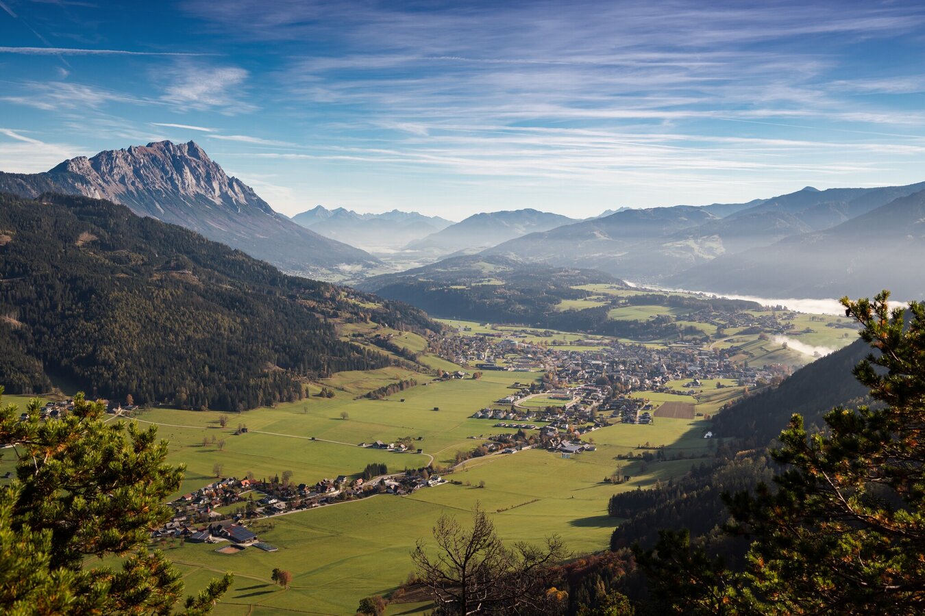
The Kulmrunde G10 in the Gröbminger Land exercise arena is an approximately 10 km long hiking route that takes around 2.5 to 3 hours. It leads from the centre of Gröbming to the Kulm (1,039 m), a vantage point with impressive panoramic views of the Gröbminger Land and the Schladminger Tauern. The route runs along well-surfaced hiking trails, partly through meadows and forests, with a moderate ascent of approx. 400 metres. The trail is suitable for hikers in average physical condition. The return journey can follow the same route or an alternative route. The hike offers a wonderful mixture of nature experience and breathtaking views and is particularly recommended in spring, summer and autumn.
The tour
partially open
moderate
publicly accessible
Starting and end point
center of Gröbming
Tour characteristics
Distance: 6 km
Fitness (3/6)
Skills (2/6)
Information
Distance: 6 km
Duration:
2:15 h
Ascent: 400 m
Descent: 400 m
highest point: 1039 m
Best season
Jan
Feb
Mar
Apr
May
Jun
Jul
Aug
Sep
Oct
Nov
Dec
Map, elevation profile & further information
This tour starts in the center of Gröbming (parking lot: "Alte Post" - behind the bus station or from the "Gasthaus zur Post"). From there, follow the path past the elementary school in the direction of Kulmweg. The marked trail no. 13 leads over a steep meadow ridge to the next crossroads. A spectacular panoramic view opens up after the first ascent: Gröbming spreads out in front of you, while the mighty Grimming and the striking peaks of Gesäuse are enthroned in the background. The path continues over rooty sections until a new perspective opens up - this time with a view to Stoderzinken and Kammspitze. Descending slightly to the right on the north side, the trail leads you along a steep forest path (Haasweg) to the highest point, the Kulm (1039 m), which once again demands your last reserves of strength.
The south-facing descent via the Pircher farmstead and high trail no. 13 offers a wonderfully secluded circular route back to Gröbming.
The south-facing descent via the Pircher farmstead and high trail no. 13 offers a wonderfully secluded circular route back to Gröbming.
Trail conditions
From Schladming: Leave the B320 Ennstalbundesstraße at the Gröbming exit. After the traffic circle, take the 2nd exit towards Kurpark. Once there, park at one of the parking lots described (Gasthaus zur Post, Gröbming bus station).
From Stainach: Leave the B320 Ennstalbundesstraße at the Gröbming exit. After the traffic circle, take the 3rd exit towards Kurpark. Once there, park in one of the parking lots described (Gasthaus zur Post, Gröbming bus station). These two free parking lots are available:
From Stainach: Leave the B320 Ennstalbundesstraße at the Gröbming exit. After the traffic circle, take the 3rd exit towards Kurpark. Once there, park in one of the parking lots described (Gasthaus zur Post, Gröbming bus station). These two free parking lots are available:
- Parking lot behind the Gröbminger bus station
- Parking lot behind the Gasthaus zur Post
Tourist information: Gröbming information office
- From Schladming: Busline 900
- From Stainach: Busline 901
More information about public transportation: Bus timetable


