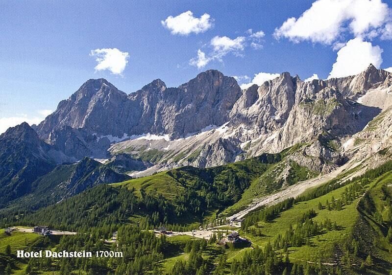
Ramsau am Dachstein
Hike to the Südwandhütte
Hiking trail
Data:
Tour description
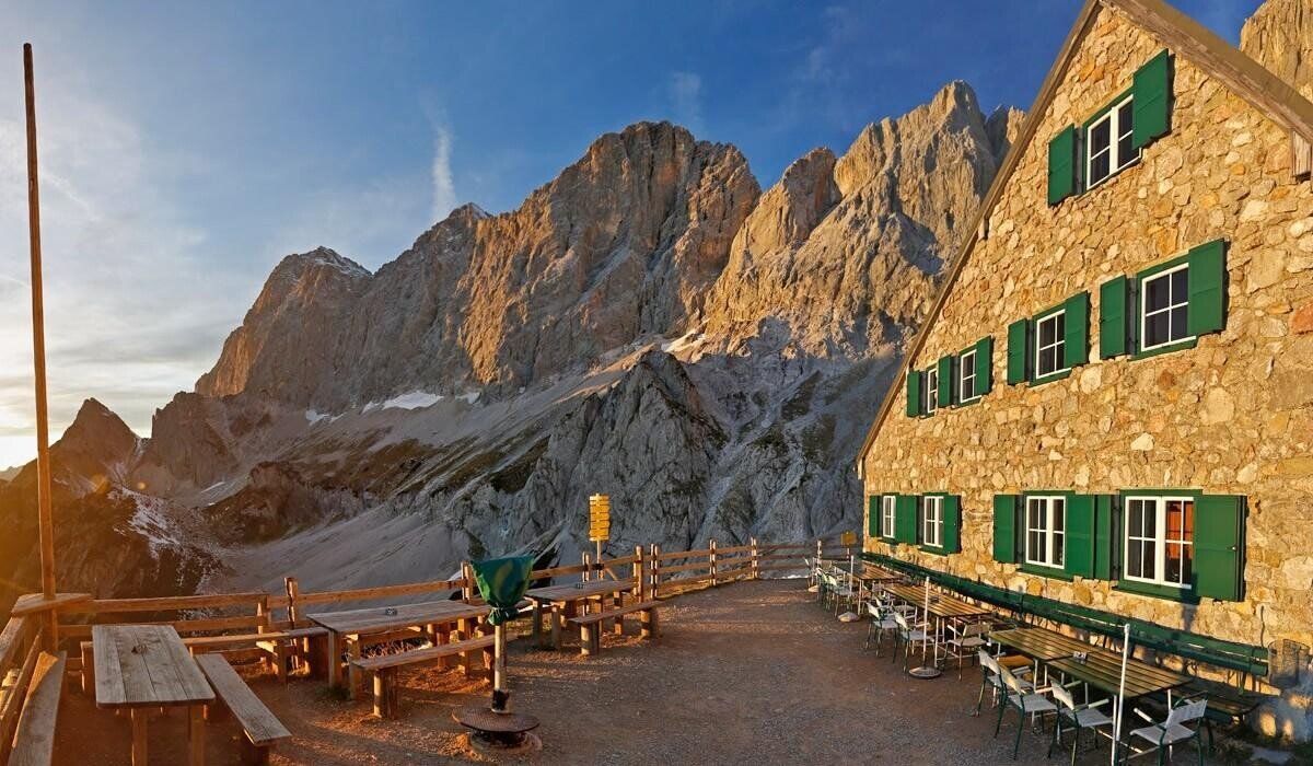
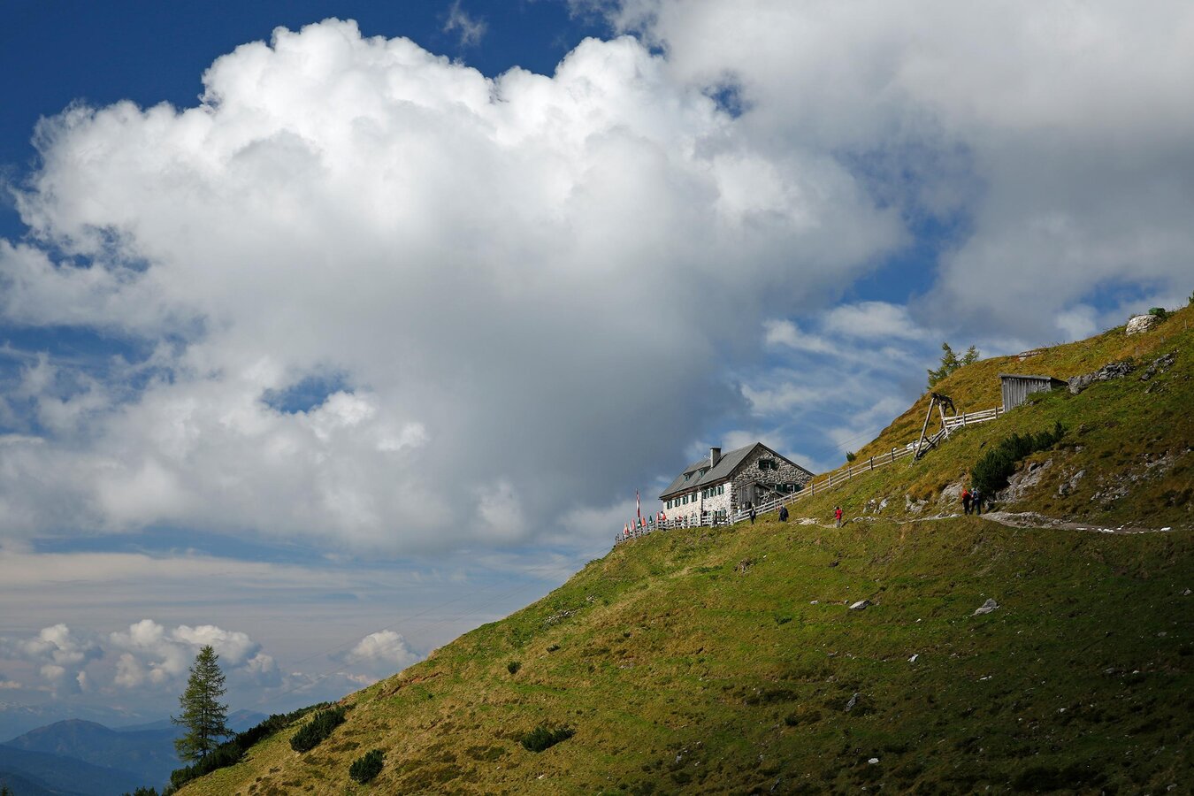
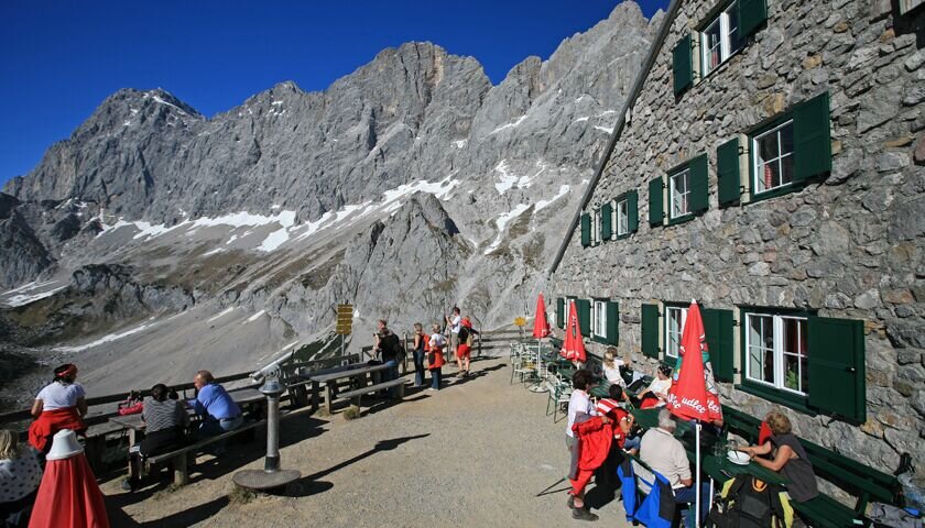
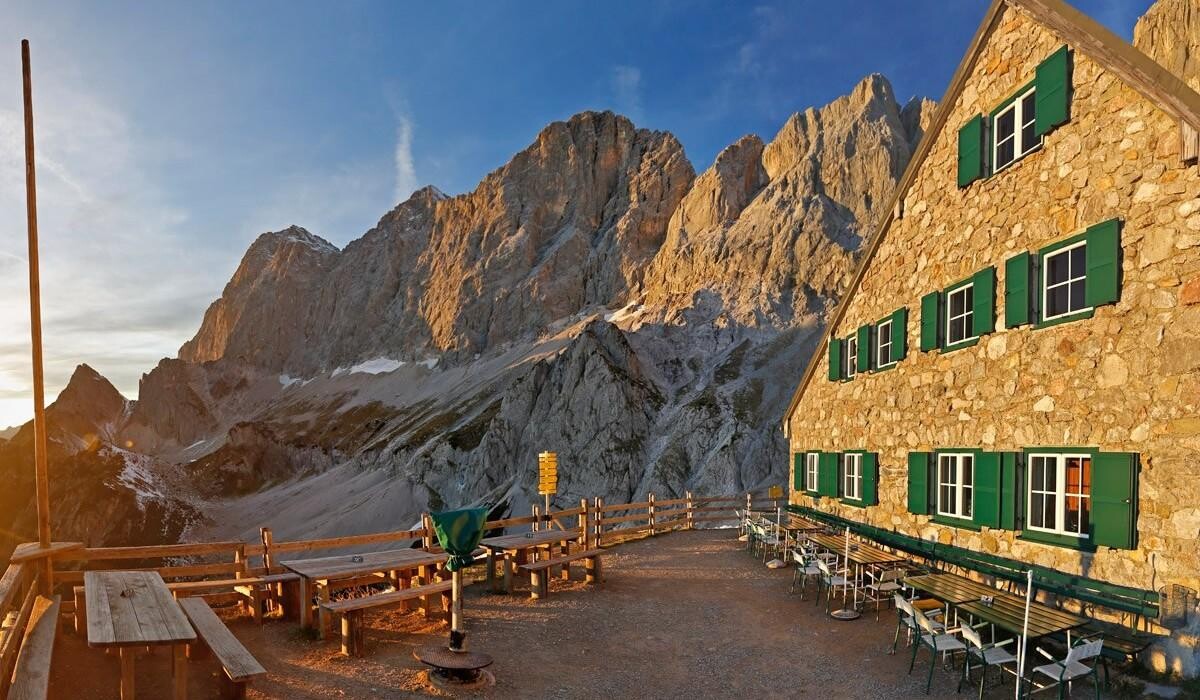
The trail to the Südwandhütte is a high alpine hike at the foot of the imposing Dachstein south walls. The trail is wonderfully situated on the sunny side of the mountain, making the hike a pleasure until late autumn. The Dachstein Südwandhütte itself is located at 1,871 m above sea level, in the high alpine pasture area of Ramsau. The hut is staffed (self-service) and offers traditional hut dishes. Here you can enjoy the magnificent panorama from the spacious terrace to the imposing Dachstein massif and the Schladminger and Radstädter Tauern mountains.
The tour
moderate
publicly accessible
Starting and end point
Berghotel Türlwand
Tour characteristics
Distance: 3.4 km
Fitness (2/6)
Skills (3/6)
Information
Distance: 3.4 km
Duration:
1:30 h
Ascent: 190 m
Descent: 190 m
highest point: 1871 m
Best season
Jan
Feb
Mar
Apr
May
Jun
Jul
Aug
Sep
Oct
Nov
Dec
Map, elevation profile & further information
The hike begins at the car park of the Dachstein Gletscherbahn valley station. The trail begins to the right of the valley station building. At first, trail no. 615 leads gently uphill along the slope below the cablecar ropes. Later it makes a generous left curve and leads at the foot of the "Zughalswand" with a magnificent view of the mountain world of the Niedere and Hohe Tauern to the Südwandhütte.
Trail conditions
From the west: Tauern Autobahn (A 10) to Knoten Ennstal
- turnoff direction Graz/Schladming - stay on the Ennstal-Bundesstraße
(B320) for approx. 20 km until Schladming - take the turnoff for Ramsau.
From the north: Pyhrn Autobahn (A 9) direction Liezen - take the Ennstal-Bundesstraße (B320) to Schladming - turnoff Ramsau.
Continue across the Ramsau plateau to the Dachsteinstraße junction. Take the toll road to the valley station of the Dachstein Glacier cable car. This is the starting point.
From the north: Pyhrn Autobahn (A 9) direction Liezen - take the Ennstal-Bundesstraße (B320) to Schladming - turnoff Ramsau.
Continue across the Ramsau plateau to the Dachsteinstraße junction. Take the toll road to the valley station of the Dachstein Glacier cable car. This is the starting point.
Parking is available at the starting point near the Dachstein cablecar valley station
The best way to reach the starting point of the hike is by taking bus line 960 from Schladming town center or train station, or from Ramsau village. Take the bus to the final stop – the Dachstein Gletscherbahn bus stop atHotel Türlwand.
See the timetables HERE
In spring there may still be snow on the path. Good hiking equipment, sturdy shoes, hiking poles
The Südwandhütte is the starting point for hikes, via ferratas and climbing routes.
For the return journey, a route via Schönbühel and Steinfeld is possible.
For the return journey, a route via Schönbühel and Steinfeld is possible.
Click here for the homepage of the Südwandhütte
Hiking map Schladming-Dachstein, 1:50,000, available in the information offices
Hiking guide Schladming-Dachstein by Herbert Raffalt (available only in German), available in the information offices


