Ramsau am Dachstein
Tor Hike
Hiking trail
Data:


Tour description
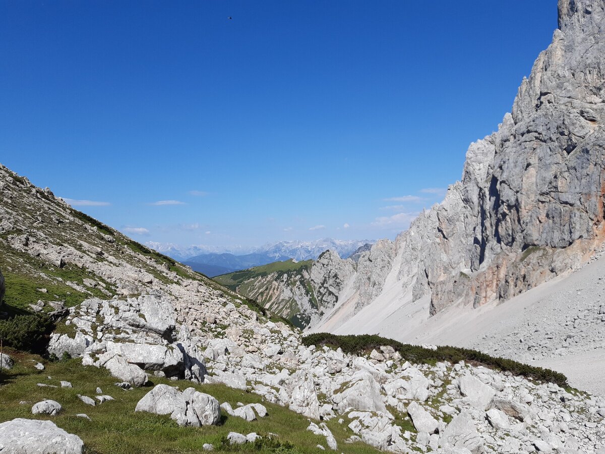
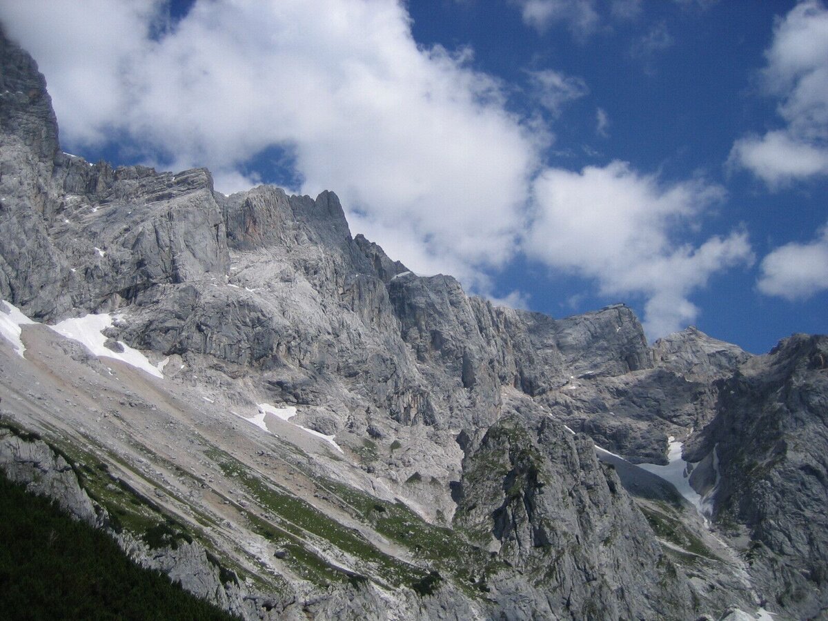
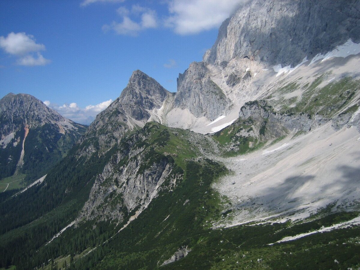
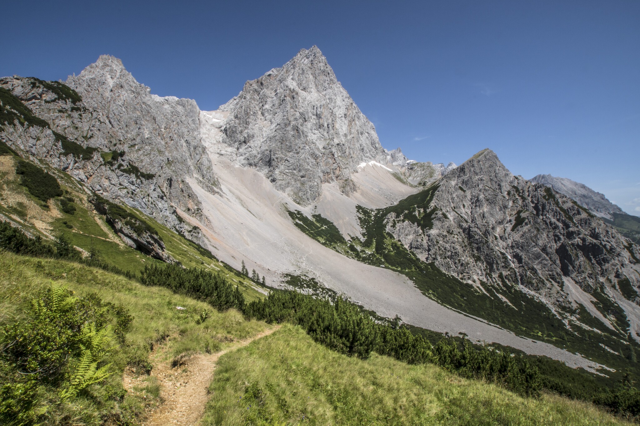
The raw power of the towering south faces of the Dachstein, Mitterspitz, and Torstein makes this tour unforgettable. On the Pernerweg trail, you'll pass through the "Tor" (gate) between the Torstein and the Raucheck, which lies in front of it.
The tour
difficult
publicly accessible
Starting and end point
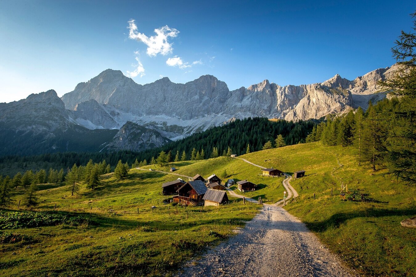
Neustattalm
Tour characteristics
Distance: 14.2 km
Fitness (5/6)
Skills (4/6)
Information
Distance: 14.2 km
Duration:
5:30 h
Ascent: 875 m
Descent: 875 m
highest point: 2033 m
Best season
Jan
Feb
Mar
Apr
May
Jun
Jul
Aug
Sep
Oct
Nov
Dec
Map, elevation profile & further information
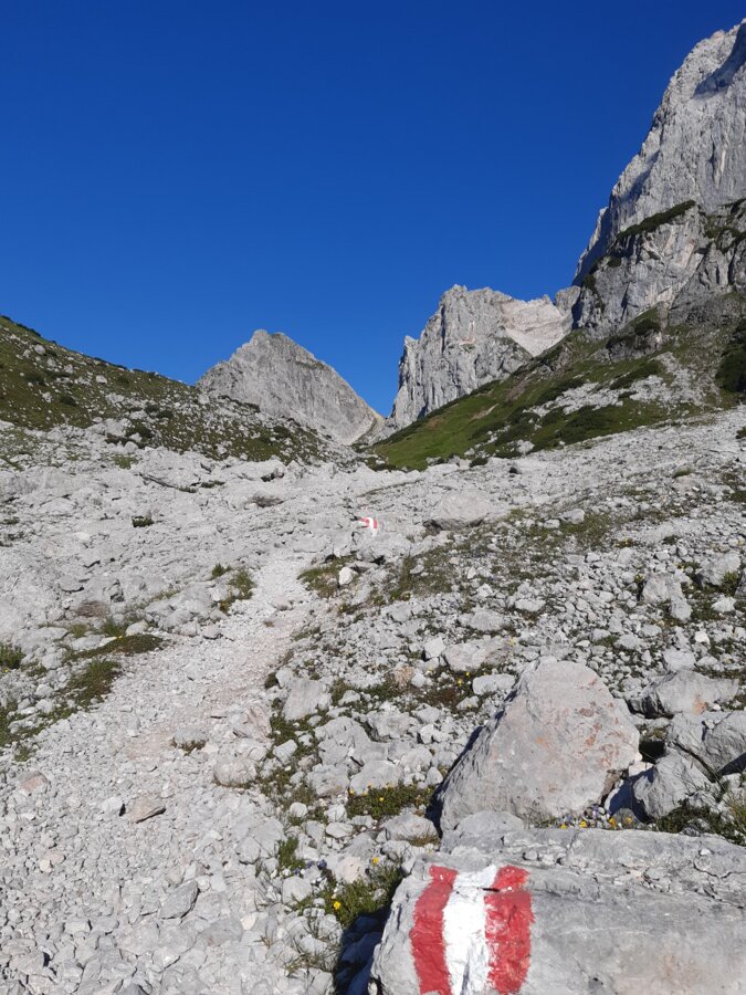
From the Dachstein road, take the alpine path down to the Neustattalm, from where the trail leads you through a sparse larch forest to the Maralmboden. Continue along a wide forest and alpine path towards the Bachlalm. At the crossroads near the Schaidlalm, follow trail #614 uphill towards Sulzenhals and Tor. After a short stretch through a sparse larch forest, you reach a crossroads where you continue following trail #614. The path leads uphill, partly over scree slopes, to the "Tor," the natural gap between the Raucheck and Torstein. On the way, you'll pass the junction towards the Windlegerscharte, which is also the route of trail #614.
From this crossroads, follow trail marker #617 – the Pernerweg. You'll soon reach the impressive gap below the Torstein, after which there's a short, steep descent. The trail then leads impressively past the mighty south faces of the Dachstein to the Südwandhütte. From there, head towards the Dachstein Glacier Cable Car valley station. Follow alpine paths past the Hunerkogel Inn and the Walcheralm back to the starting point. If you arrived by public transport, you can take bus line 960 from the Gletscherbahn valley station, Hotel Dachstein, Walcheralm, or Glösalm stops back down to the valley.
From this crossroads, follow trail marker #617 – the Pernerweg. You'll soon reach the impressive gap below the Torstein, after which there's a short, steep descent. The trail then leads impressively past the mighty south faces of the Dachstein to the Südwandhütte. From there, head towards the Dachstein Glacier Cable Car valley station. Follow alpine paths past the Hunerkogel Inn and the Walcheralm back to the starting point. If you arrived by public transport, you can take bus line 960 from the Gletscherbahn valley station, Hotel Dachstein, Walcheralm, or Glösalm stops back down to the valley.
From the west: Tauern Autobahn (A 10) to Knoten Ennstal
- turnoff direction Graz/Schladming - stay on the Ennstal-Bundesstraße
(B320) for approx. 20 km until Schladming - take the turnoff for Ramsau.
From the north: Pyhrn Autobahn (A 9) direction Liezen - take the Ennstal-Bundesstraße (B320) to Schladming - turnoff Ramsau.
Continue across the Ramsau plateau to the Dachsteinstraße junction. Take the toll road to the parking lot at the turn-off Neustattalm/Walcheralm.Parking lot Neustattalm
From the north: Pyhrn Autobahn (A 9) direction Liezen - take the Ennstal-Bundesstraße (B320) to Schladming - turnoff Ramsau.
Continue across the Ramsau plateau to the Dachsteinstraße junction. Take the toll road to the parking lot at the turn-off Neustattalm/Walcheralm.Parking lot Neustattalm
The best way to reach the starting point of the hike is by taking bus line 960 from Schladming town center or train station, or from Ramsau village. Take the bus to the stop Glösalm. From there it's about a 10-minute walk up to the start of the tour at the Neustattalm junction.
See the timetables HERE
A good backpack is helpful, and for routes in alpine terrain, a hat, gloves, a good jacket, and trousers are essential. Sturdy, ankle-high footwear, hiking poles, sunglasses, sunscreen, and sufficient water are crucial. A flashlight, maps, a knife, and a small first-aid kit are also necessary.
Schladming-Dachstein
Hiking map Schladming-Dachstein, 1:50,000, available in the information offices
Hiking guide Schladming-Dachstein by Herbert Raffalt (available only in German), available in the information offices


