Tor Hike

trudne Hiking · Ramsau am Dachstein

Charakterystyka wycieczki
Warunek
Technika
Informacje o wycieczce
Trasa: 13.25 km
Okres obowiązywania: 05:30 h
Wejście: 968 m
Zejście: 968 m
Najlepsza pora roku
Styczeń
Luty
Marzec
Kwiecień
Maj
Czerwiec
Lipiec
Sierpień
Wrzesień
Październik
Listopad
Grudzień
Wycieczka
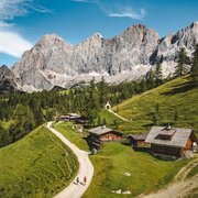
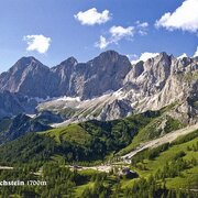
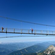
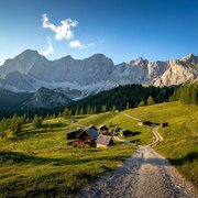
The impressive south walls of the Dachstein, Mitterspitz and Torstein, make this an unforgettable tour. An alpine path leads you through gravel and forestry trails. 
Opis drogi
Starting at Neustattalm, the path follows through a larch forest to the Maralmboden and onto the Bachlalm. Partly over scree fields, the path leads up to the Tor, the natural notch between the Raucheck and Torstein mountains. A short, but steep descent along Pernerweg (path no. 617) passes Dachstein's south face along to the Südwandhütte. From there, make your way back down to the Dachstein gondola base station and follow the Dachstein road to your starting point.
Przyjazd

Arriving from the west:From the west you can take the Munich-Salzburg motorway, continuing on the Tauern motorway (A 10) until the Ennstal junction. From here take the Ennstal A-road (the B 320) for around 30 km into the Schladming-Dachstein region, then take the Ramsau am Dachstein turn-off.

Arriving from the north:From the south-east take the Pyhrnautobahn motorway (A 9) to the Liezen junction and then the Ennstal A-road (B 320) into the Schladming-Dachstein region. Then take the Ramsau am Dachstein turn-off.

Bus stop Walcheralm

See the timetables HERE

Parkowanie
Start
Neustattalm
Cel
Neustattalm
Equipment
hiking boots and poles

To też może Cię zainteresować

Prognoza pogody

Wybierz datę
rano
2°C
w południe
0°C
wieczorem
-3°C
Snowfall will continue into the afternoon, then the clouds will break up.
rano
-6°C
w południe
-2°C
wieczorem
-4°C
Partly sunny in the morning, gradually becoming cloudy in the afternoon.
rano
-5°C
w południe
-5°C
wieczorem
-6°C
A mixture of sunny periods and scattered snow showers.

Podobne wycieczki w okolicy